Beyond the Destination Tours

Colorado River Journey Guide

Colorado River

A source-to-desert journey following the Colorado River story from Rocky Mountain headwaters through red-rock canyon country, tribal lands, reservoirs, great dams, desert recreation corridors, and the lower river at Yuma.

The Colorado River changes character repeatedly—beginning as a young mountain river west of the Continental Divide, cutting through the Colorado Plateau, reappearing below Glen Canyon Dam at Lees Ferry, carving the Grand Canyon, filling Lake Mead and Lake Mohave, and continuing south through Lake Havasu toward the Sonoran Desert.

Use this guide to see whether a long, one-way river journey fits your travel style. The 16-day pacing gives Cedar Mesa, Monument Valley, Page, Lees Ferry, and Grand Canyon enough room to be experienced rather than rushed through.

Find the Journey That Fits You
Colorado River flowing through red-rock canyon country near Fisher Towers, Utah

Who This Journey Is For

This journey suits travelers who want more than a collection of famous Southwest viewpoints. It connects landscapes through one idea—how the Colorado River and its tributaries shape geology, communities, travel, settlement, recreation, agriculture, power, and life in an arid West.

The River-Story Traveler: Wants to follow the Colorado from mountain headwaters into canyon and desert country rather than experience each park as an isolated stop.

The Scenic-Road Traveler: Values Trail Ridge Road, Colorado Plateau highways, desert byways, historic Route 66, and lower-river corridors as part of the experience rather than simply transportation.

The Culture-and-History Traveler: Enjoys Indigenous homelands and sovereign tribal lands, historic crossings, mining and ranching landscapes, dams, river navigation, Route 66, and communities shaped by scarce water.

The Photographer: Looks for alpine light, red-rock canyons, natural bridges, river bends, canyon rims, reservoirs, desert wetlands, night skies, and changing weather.

The Short-Walk Wanderer: Prefers overlooks, nature trails, visitor-center interpretation, short canyon walks, historic sites, and river access, with strenuous hikes or water days available by choice.

The Water-and-Wildlife Traveler: Enjoys rivers, reservoirs, wetlands, bird habitat, desert bighorn country, riparian corridors, paddling possibilities, and the contrast between water and desert.

The Comfortable Explorer: Wants a long scenic road journey with comfortable hotel stays while still allowing meaningful outdoor and cultural discovery.

What It Feels Like

Entrenched meanders of the San Juan River at Goosenecks State Park in southeast Utah

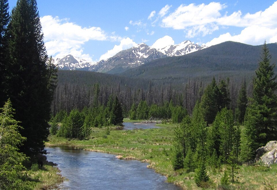
This route keeps changing scale. It begins in Rocky Mountain National Park with alpine roads, headwater valleys, and the Continental Divide; opens into western Colorado canyon country; turns red and immense around Moab, Canyonlands, Cedar Mesa, and Monument Valley; narrows again at Glen Canyon and the Grand Canyon; then widens into Lake Mead, Lake Mohave, Lake Havasu, wildlife refuges, irrigated desert, and Yuma.

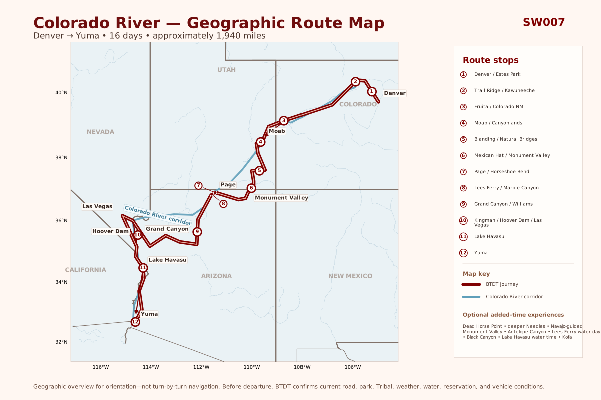
The primary trajectory runs Denver → Estes Park → Trail Ridge Road and Kawuneeche Valley → Eagle → Fruita → Moab → Blanding → Natural Bridges and Cedar Mesa → Mexican Hat → Monument Valley and Kayenta → Navajo National Monument → Page → Lees Ferry and Marble Canyon → Grand Canyon South Rim → Williams → Peach Springs and Kingman → Hoover Dam and Lake Mead → Las Vegas → Lake Havasu → Yuma.

Expect altitude and rapidly changing weather in Colorado, long-view desert roads in Utah and Arizona, high summer heat, guided-access requirements on tribal lands, rough-road decisions, park congestion, seasonal closures, water-level changes, and days when a modest mileage figure still deserves an unhurried schedule.

Places Worth Exploring

These signature places anchor the 16-day Colorado River journey. Before departure, we confirm walking options, Tribal access, reservations, road suitability, heat, water levels, and the stops that best match your interests.

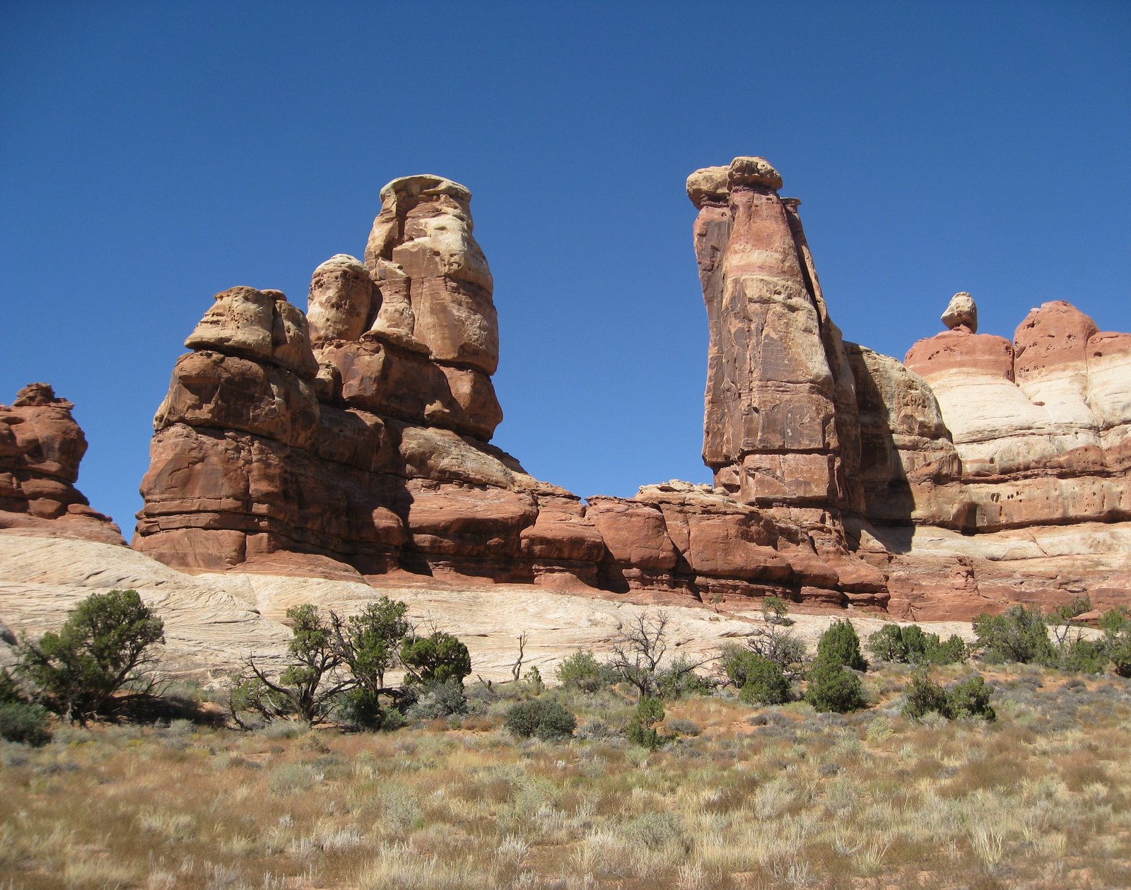
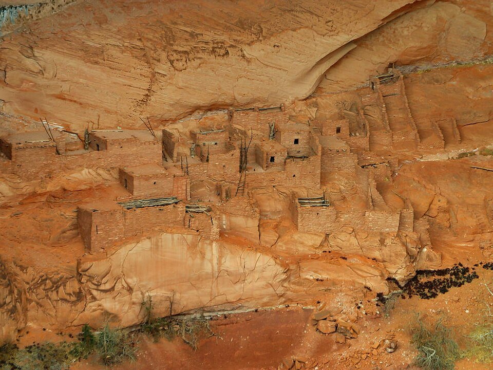
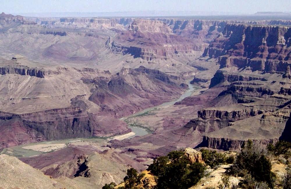
Colorado River in Rocky Mountain National Park, ColoradoRocky Mountain Headwaters & KawuneecheTrail Ridge Road crosses the Continental Divide into the Kawuneeche Valley, where short walks can bring travelers close to the young Colorado River, mountain meadows, wildlife habitat, and the scale of its high-country watershed.Rim Rock Drive in Colorado National Monument, ColoradoColorado National MonumentRim Rock Drive follows canyon walls and mesa tops above western Colorado, adding red-rock geology, short trails, CCC-era road history, and a clear transition from mountain river country into the Colorado Plateau.Mesa Arch at sunrise in Canyonlands National Park, UtahMoab & Island in the SkyThe Colorado Riverway east of Moab and the Island in the Sky district combine red-rock corridors, mesa-top overlooks, short walks, and broad views into the Colorado-Green canyon system.Sandstone spires in the Needles District of Canyonlands National Park, UtahCanyonlands — The NeedlesThe Needles brings travelers closer to Cedar Mesa sandstone through a paved scenic road, interpretive trails, and optional deeper hiking when heat, time, and trail conditions support it.Owachomo Bridge in Natural Bridges National Monument, UtahNatural Bridges & Cedar MesaNatural Bridges, the Moki Dugway, Muley Point, Valley of the Gods, and the San Juan country create a concentrated sequence of water-carved stone, immense viewpoints, and remote high-desert roads.Betatakin cliff dwellings in Navajo National Monument, ArizonaNavajo National MonumentBetatakin and the monument’s visitor-area trails add Ancestral Puebloan architecture and interpretation before the journey continues across Navajo Nation toward Page. Monument Valley is approached separately through Navajo-controlled visitor guidance.Horseshoe Bend of the Colorado River near Page, ArizonaPage, Horseshoe Bend & Glen CanyonHorseshoe Bend, Glen Canyon, and guided slot-canyon possibilities shift the route back toward a visible Colorado River, with reservations, heat, flash-flood risk, and tribal access shaping the day.Colorado River viewed from the Desert View area of Grand Canyon National ParkGrand Canyon — Desert View to South RimEntering from Desert View lets the canyon unfold from east to west through overlooks, short rim walks, cultural interpretation, changing light, and one of the route’s strongest expressions of the river’s erosional work.
Stories & Possibilities

Some experiences fit naturally into the journey, while others deserve a deliberate half-day, full day, or additional overnight. The final balance reflects your interests, access requirements, vehicle suitability, reservations, and the pace you want to keep.

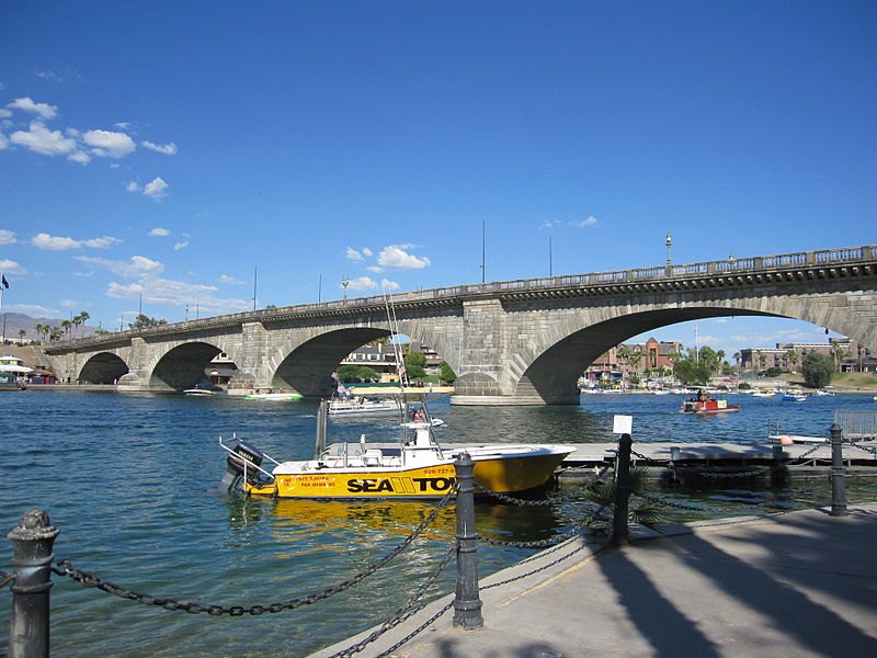
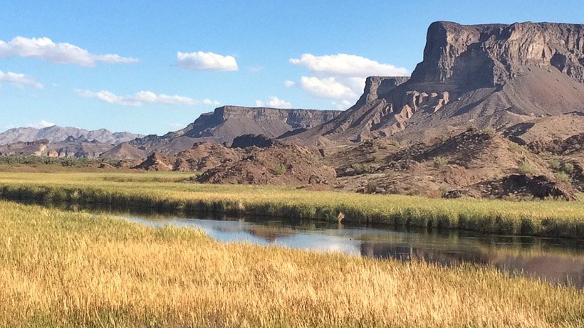
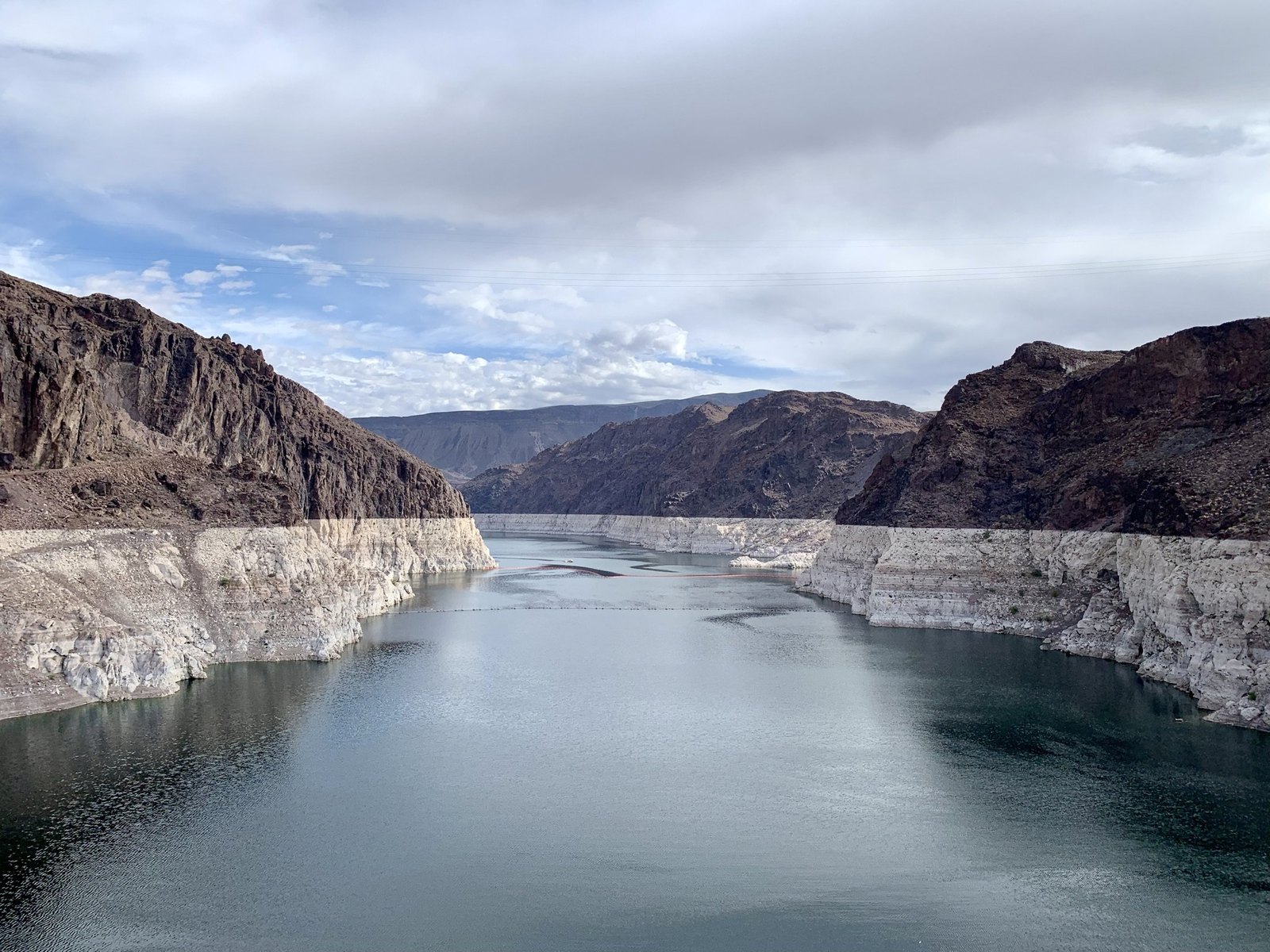
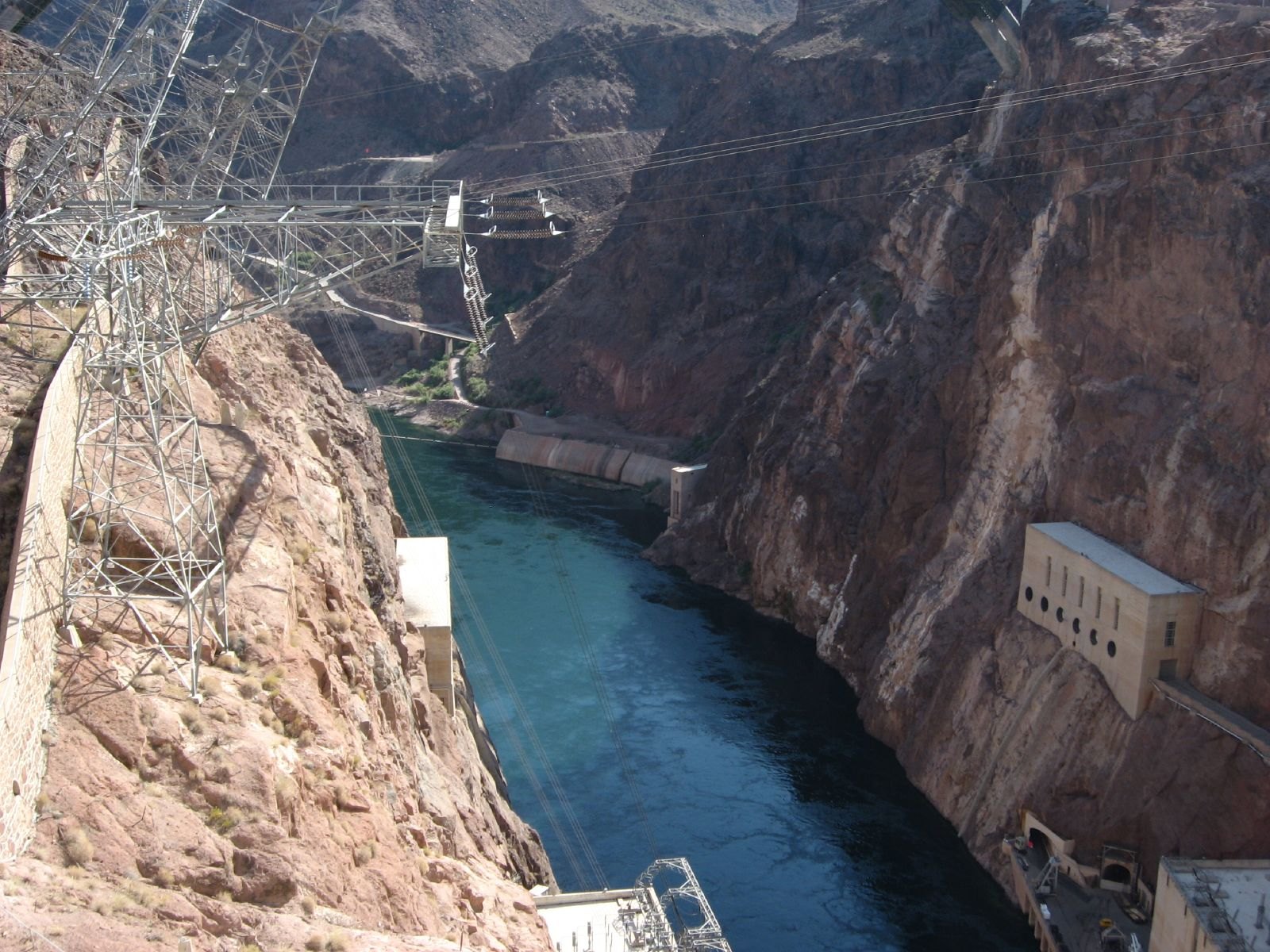
Colorado River and Navajo Bridges in Marble Canyon near Lees Ferry, ArizonaNavajo Bridge & Lees FerryNavajo Bridge and Lees Ferry bring the journey directly back to the Colorado. Historic sites, riverbank access, smooth-water rafting, kayak backhaul, or fishing can deepen this section when deliberately scheduled.Lake Mead viewed from Hoover Dam on the Colorado RiverHoover Dam & Lake MeadHoover Dam and Lake Mead turn the river story toward engineering, hydropower, water storage, urban growth, and recreation; tour availability and current reservoir conditions are confirmed before departure.Black Canyon and Colorado River below Hoover DamBlack Canyon National Water TrailA guided raft or paddle day below Hoover Dam can add caves, beaches, hot-spring country, and a water-level view of one of the river’s defining engineered landscapes.London Bridge on the Colorado River at Lake Havasu City, ArizonaLake Havasu Water DayKayaking, swimming, boating, shoreline trails, or a relaxed lake day can soften the long overland rhythm before the final Sonoran Desert leg, with heat and water conditions controlling the choice.Wetlands and desert cliffs at Bill Williams River National Wildlife Refuge, ArizonaBill Williams River RefugeWetlands, desert cliffs, wildlife watching, trails, and non-motorized river access can add a strong ecological counterpoint where the Bill Williams River meets the lower Colorado.Palm Canyon in Kofa National Wildlife Refuge, ArizonaKofa & Palm CanyonKofa can add Sonoran Desert geology, wildlife habitat, and Palm Canyon when heat, road conditions, vehicle suitability, and daylight make the detour practical.Historic Ocean-to-Ocean Bridge across the Colorado River at Yuma, ArizonaYuma — Historic Colorado CrossingYuma closes the journey with the river as transportation corridor and civic landscape: historic crossing infrastructure, Territorial Prison history, the old Quartermaster Depot, parks, and modern riverfront recreation.

Journey Style

The 16-day journey keeps the full river arc from the Rocky Mountains to Yuma while giving Cedar Mesa, Monument Valley, Page, Lees Ferry, and Grand Canyon more breathing room.

PaceModerate to expansive; long-route flexibility essential WalkingLight to moderate, with longer hikes and water days available by choice SceneryAlpine valleys, red-rock canyons, river bends, reservoirs, desert mountains, wetlands LearningRiver geology, Indigenous homelands and sovereignty, settlement, dams, hydropower, irrigation, conservation, recreation, and water scarcity Night SkyStrong opportunities in canyon country and desert areas when conditions align LodgingComfortable, well-located hotels chosen for the journey; camping or special-location stays can be considered when they enhance the experience Route16 days • approximately 1,940 miles • one-way

You may feel at home if you want one of BTDT’s broadest Western journeys—a trip in which mountain scenery, tribal lands, canyon country, water history, wildlife, engineering, Route 66, and desert communities all connect through the Colorado River story.

Snow, high-country road closures, desert heat, monsoon storms, wildfire or smoke, Tribal access rules, guided-tour availability, rough roads, park congestion, Grand Canyon access and services, and reservoir conditions can affect the pace and routing of your journey.

People & Place

The Colorado River is not an empty scenic line on a map. The route crosses living homelands and sovereign tribal lands, mountain communities, agricultural valleys, national parks, historic highways, reservoir towns, wildlife refuges, and cities whose growth is inseparable from Western water.

Living Homelands & Sovereign Nations

The route must distinguish the many Indigenous peoples and sovereign nations connected to these landscapes rather than treating the Southwest as one generic cultural story. Navajo-controlled visitor information guides Monument Valley and Antelope Canyon; Hualapai-authorized sources guide Peach Springs and any river access through Hualapai lands.

River, Canyon & Living Systems

Snowmelt, tributaries, riparian habitat, canyon erosion, desert springs, reservoirs, wetlands, wildlife refuges, and changing water levels connect the route’s natural systems from Colorado to Yuma.

Dams, Towns & Working River

Roads, ranching, mining, tourism, river recreation, irrigation, hydropower, dam construction, military supply routes, Route 66, agriculture, and rapidly growing desert cities all shape the modern human relationship with the Colorado River.

Could This Be Your Journey?

This journey may be a good fit if you want to understand the Southwest through one continuous river story rather than a checklist of disconnected parks—moving from Rocky Mountain headwaters to Utah canyon country, tribal landscapes, Grand Canyon, great reservoirs, and the lower desert river.

Lodging: Comfortable hotel stays form the usual foundation of the journey; camping, river lodges, or special-location stays can be considered when access, season, comfort, and your preferences make them a good fit.

I’m Ready to Plan This Journey →

Photo Credits & Sources: View credits and sources.